News Story
Historic CURN Drone Flight Crosses Chesapeake Bay
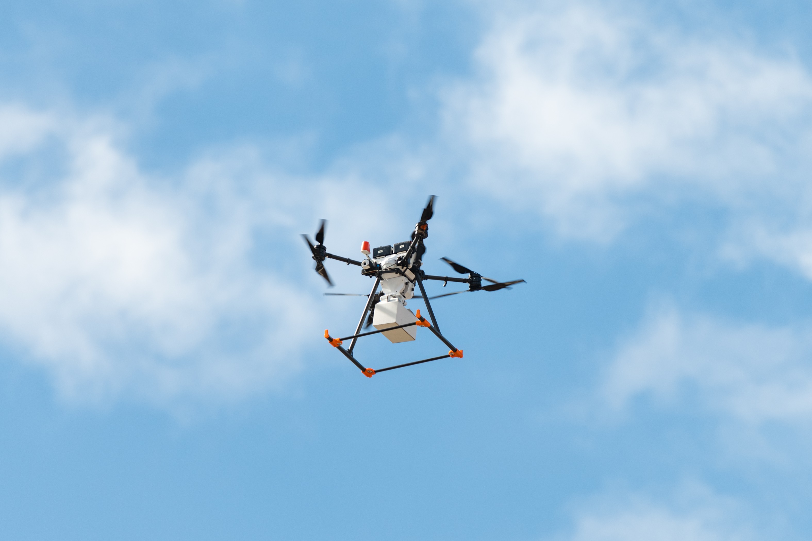
KITTS POINT PENINSULA, Md.—The University of Maryland UAS Research and Operations Center (UROC) successfully completed a historic milestone in advanced aviation through its Chesapeake UAS Route Network (CURN) initiative, conducting the first non-Department of Defense-sponsored beyond visual line of sight (BVLOS) drone flight across the breadth of the Chesapeake Bay.
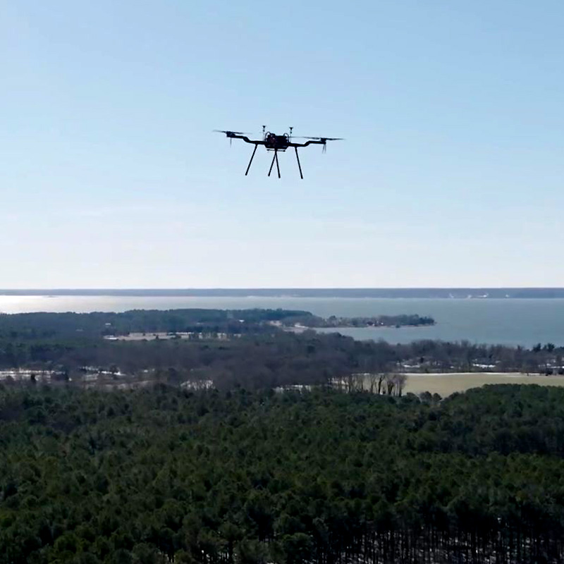
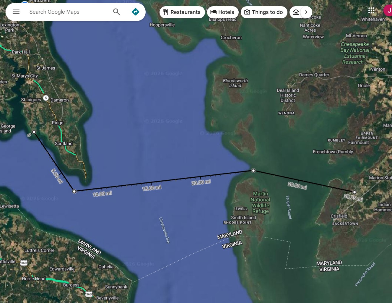 On Sunday, June 14, UROC's Penguin B Vertical Takeoff and Landing (VTOL) Uncrewed Aircraft System (UAS) departed from Kitts Point Peninsula in St. Mary's County and traveled approximately 33 miles to Crisfield on Maryland's Eastern Shore before landing, re-launching, and returning to Kitts Point Peninsula—all without the use of a chase aircraft or visual observers.
The flight marks the first cross-Chesapeake Bay BVLOS operation in UROC history and demonstrates the growing capability of uncrewed aircraft systems to safely connect communities separated by geographic barriers.
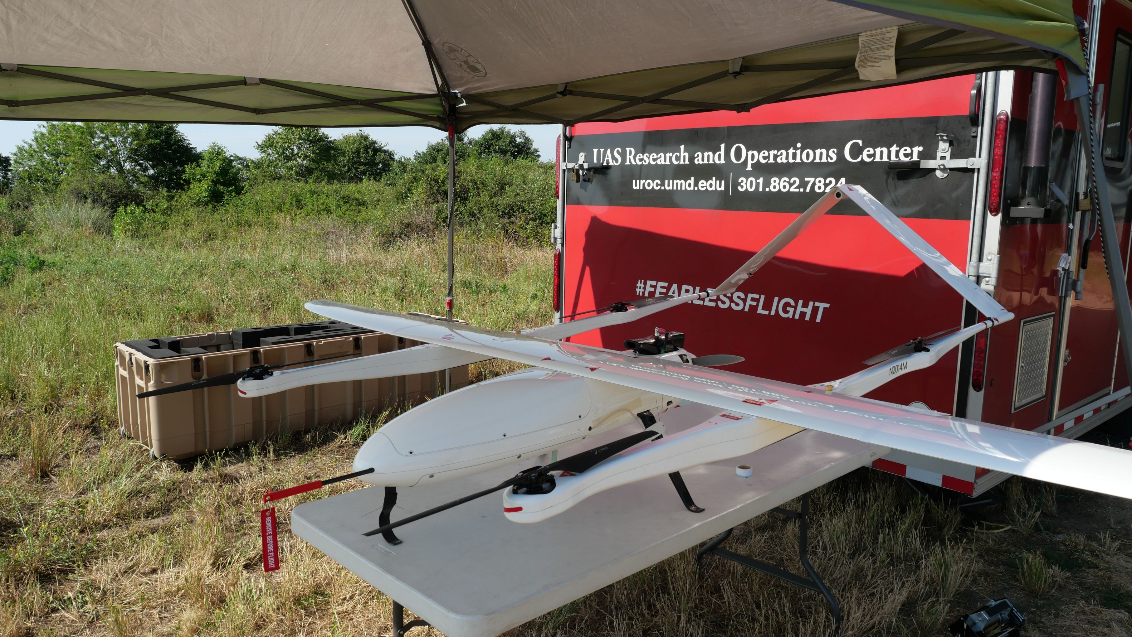
Ground crews used Kongsberg Geospatial's IRIS Terminal and uAvionix's PingStation 3 for airspace awareness and uAvionix communications systems to manage the flight. The aircraft was equipped with a CubePilot Cube Blue autopilot running ArduPilot flight control software alongside a suite of uAvionix aerial radios and transponder systems. Throughout the mission, UROC coordinated closely with Patuxent River Air Traffic Control to ensure safe operations.
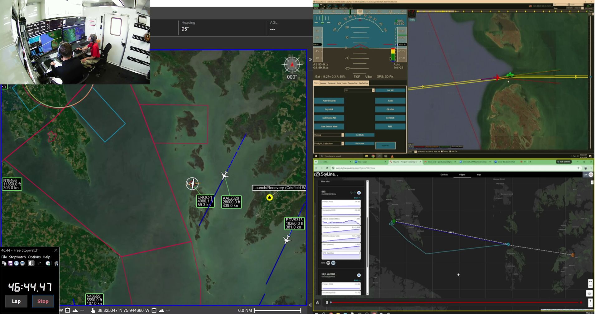 The demonstration highlighted the transformative potential of drone technology to significantly reduce travel times for critical missions across the region. While driving from St. Mary's County to Crisfield can take more than three and a half hours under ideal conditions—and can run to more than five during periods of heavy bridge traffic—the drone completed the journey in approximately 45 minutes.
The capability could support a wide range of future applications, including time-sensitive medical deliveries, emergency response operations, disaster relief efforts or even commercial cargo transport. For isolated communities such as Smith Island, where all travel requires ferry transportation, drone operations have the potential to dramatically improve access to essential services.
The Journey to Crisfield and Beyond
The June 14 flight represents a flagship achievement for the Chesapeake UAS Route Network initiative and the culmination of more than six years of research, planning, testing, and collaboration.
The project began with a feasibility study conducted between 2020 and 2021 to assess the viability of establishing a safe, efficient, and scalable uncrewed aircraft system route network across the Chesapeake Bay region for civil, commercial, and government operations.
In 2022, UROC transitioned the project from concept development to execution by creating an implementation roadmap focused on enabling routine beyond visual line of sight operations in non-segregated airspace. From the start, it was clear this would be a lengthy journey. In 2023, the project received funding from the Rural Maryland Economic Development Fund, which allowed UROC to truly get CURN moving.
"It was a textbook tutorial on how to execute a complex development and flight test campaign, and we can't wait to keep building on it into the future."
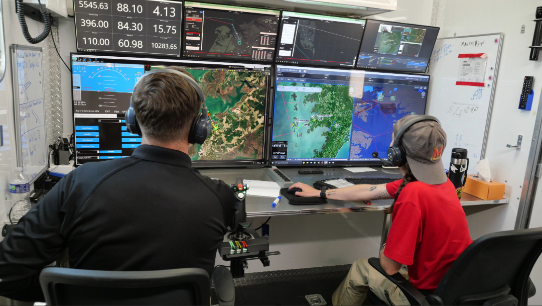 Throughout the project, UROC collaborated with the Maryland Department of Commerce, Federal Aviation Administration, the Atlantic Test Range, Patuxent River Air Traffic Control, St. Mary's County, the Tri-County Council for Southern Maryland, MITRE, The Padina Group, Sapphire Solutions, Kongsberg Geospatial, uAvionix, Edge Autonomy, Echodyne, Matrixspace, and other industry partners to develop the infrastructure, safety frameworks, operational procedures, and technologies necessary for advanced drone operations.
Between 2023 and 2025, UROC invested in operator training, simulation capabilities, command-and-control technologies, aircraft upgrades, Mobile Operations Center upgrades, and many other elements that would be necessary. Complicating matters was the constant pull on the team from numerous other projects competing for their time; however, UROC never lost sight of CURN and its goals.
While the engineering team integrated the complex avionics through numerous iterations of design/build/test/modify/test in the lab, the operations team pursued a path to the first BVLOS operations by establishing relationships at nearby Naval Air Station Patuxent River, including with the Range Safety Office, Air Traffic Control, Spectrum Management, and others. Along with a FAA Certificate of Waiver and Authorization (COA), the resultant Test Plan approved by the Atlantic Test Ranges and Pax River gave us the airspace we needed for our first cross-bay attempt.
The test campaign was complicated by the choice of ArduPilot for the Penguin B VTOL; this flight control system had never been implemented on the platform before. UROC therefore followed a disciplined development process beginning with stimulation, stepping through testing and tuning on our custom Anaconda surrogate test aircraft, and culminating in an incremental envelope expansion effort using Penguin. At every step, close coordination between engineers and operators enabled safe and thorough progression through the data points.
In early 2026, UROC conducted multiple practice flights and final system validations in preparation for the historic cross-bay mission.
Led by UROC, the Chesapeake UAS Route Network project will continue to expand its horizons to new routes and less dependency on special use airspace, establishing a foundation for future uncrewed aircraft system infrastructure that can support economic growth, attract industry partnerships, create workforce opportunities, and position Maryland as a national leader in advanced aviation innovation.
 The many investments needed were generously supported by St. Mary's County Economic Development department and the Tri-County Council for Southern Maryland, which provided critical support for the project through allocations from the Rural Maryland Economic Development Fund.
Beyond supporting research and testing for CURN, the infrastructure developed through the Chesapeake UAS Route Network is already generating new economic activity in the Southern Maryland region as well as supporting other projects aimed at public safety and health creating future high-tech jobs, and supporting Maryland's efforts to prepare for the coming low-altitude economy of the future.
For more information, visit the University of Maryland UAS Research and Operations Center and the Chesapeake UAS Route Network.
About the University of Maryland UAS Research and Operations Center
The University of Maryland UAS Research and Operations Center, part of the A. James Clark School of Engineering, conducts research, testing, and operational activities that advance the safe integration of uncrewed aircraft systems into the national airspace. UROC collaborates with government agencies, industry partners, and academic institutions to develop innovative solutions for public safety, transportation, healthcare, and emerging aviation applications.
Published June 17, 2026
Recent Stories
Stories / Aug 13, 2026
UMD Lauded at DARPA Lift Challenge

Stories / Jun 17, 2026
Historic CURN Drone Flight Crosses Chesapeake Bay

Stories / Apr 16, 2026
UROC Engineer Earns Newcomer Award

Stories / Oct 2, 2025
Taking Healthcare Higher: Drones Deliver Medicine in Crisfield
Stories / Aug 18, 2025
Summer Interns Build Pro-Level Skills at UROC
Stories / Jul 1, 2025
Robot-Assisted Triage: UMD Team Answers the Challenge
Stories / Jun 26, 2025
Celebrating a Legend: Musings from Matt Scassero

Stories / Mar 21, 2025
Maryland Readies for Aviation Revolution
Stories / Mar 10, 2025
Medical Deliveries by Drone: WBAL-TV Highlights UROC Tests
Stories / Dec 12, 2024
Rob Neuner: Charting a Course for UAS Industry Growth
